Contact our sales team for the latest BDT price, base/rover package options, and delivery timeline.
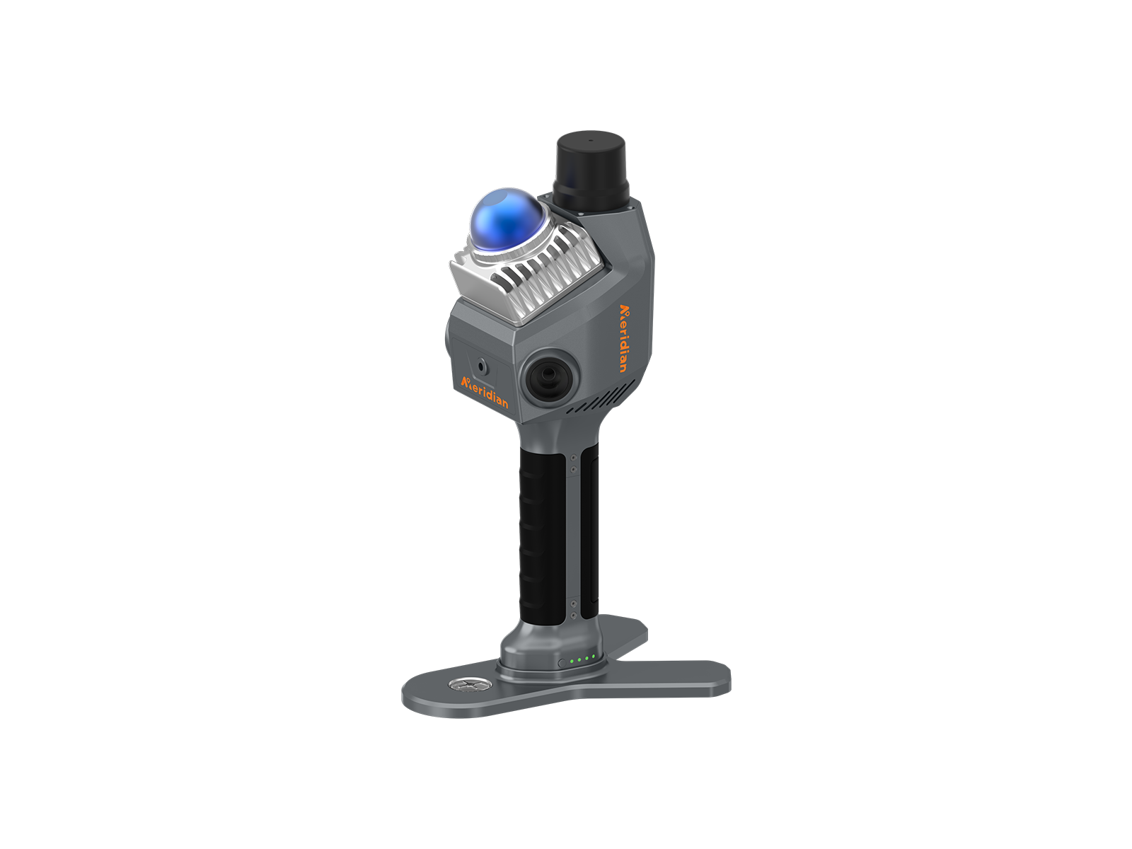
The MS70 Handheld LiDar Scanner is a groundbreaking tool that revolu tionizes 3D data collection. This lightweight device combines a 20° tilt mechanism, dual wide-angle cameras, and an integrated RTK module to accurately capture nprecedented detail and vibrant color scans. It Integrates advanced point cloud algorithms, enabling one-person opera tion to quickly obtain comprehensive color point cloud easily obtain true 3D information and complete spatial mapping.
The point cloud thickness is within 1cm, and relative accuracy can reach 1cm. The MS70 utilizes advanced RTK and SLAM echnologies to deliver stable, accurate, and reliable positioning data. Deep integration of LiDAR and imaging technologies, combined with advanced point cloud
algorithm, ensures accurate and realistic 3D reconstructions.
The built-in RTK module allows for one-click operation, simplifying the scanning process and reducing setup time, no external antennas or 4G cards required. Meridian Lidar Studio for one-click point cloud genera tion and export.
Industry-leading color point cloud effects with real-time feedback. The standard software provides real-time feedback on data collection status and a live preview of color point clouds, ensuring no data is missed during scanning
With a weight of only 1.0 kg, it is easy to carry and operate. Two 16 MP wide-angle fish-eye lenses and 20° tilt mechanism allows the
scanner to capture full field-of-view coverage and highly detailed imagery, MS70 captures large amounts of data quickly, saving time
and maintaining accuracy
3150 mAh batteries provide up to 150 minutes of continuous scanning each, ensuring extended operation in the field.
Type-C PD-30W charging ensures an average charging time of just 1.5 hours, minimizing downtime.
Become a 3D scanning expert in minutes. Meridian Lidar Go lets you control the MS70 Slam Scanner with ease. Capture every detail in real-time color point clouds. Start scanning instantly with plug-and-play simplicity.
Generate high-quality point cloud data with one click. Meridian Lidar Studio processes your scans efficiently. Intuitive measurement and analysis with image and point cloud overlays. Transform your data into real-life reconstructions effortlessly.
| RTK Performance | 0.8 cm + 1 ppm (H) 1.5 cm + 1 ppm (V) |
| Processing | Real-time processing Post processing |
| Support satellite | 7 satellites system, 24 channels |
| Range Noise | ±1 cm |
| Precision Indoor | ±1 cm |
| Point Cloud Thickness | ≤1cm |
| Accuracy | Absolute Accuracy ≤ 5cm; Relative Accuracy ≤ 1cm |
| Mobile App | Supports preview of color point clouds, Android compatibility |
| Processing Software | Supports spatially correlated viewing of point clouds and panoramic |
| Robustness | Designed for indoor and outdoor use |
| Temperature | Operating: -20 ~ +55℃ Storage: -20 ~ +60℃ |
| IP Rating | IP54 |
| Camera | 16 MP * 2 |
| Camera FOV | 360 * 270° |
| Laser Class | Class 1/905nm |
| LiDAR FOV | Horizontal 360° Vertical -7°~52° |
| Point Measurement Rate | 200,000 pts/sec |
| Frequency | 10 hz |
| Range | 0.1 ~ 40 m @ 10% 0.1 ~ 70 m @ 80% |
| Weight | 1079g(with battery) |
| Size (mm) | 110.5 * 140 * 313.3mm(with Battery) 110.5 * 114 * 143.1mm(mainframe) |
| Battery | 3150 mAh Quick-release grip battery (Max. 150 mins battery life for each) |
| Input | 14.4 v |
| Charging | Type-C, PD-30 W (Average 2 hr charging time ) |
| Format | .las, .pcd, .ply |
| Detachable Storage | TF Card, 256GB, max 1T extendable |
| Data Transfer | Wireless and USB 3.0 |
| Operation | Support surveying pole connection |
* Specifications may vary by configuration. Please confirm with our team before ordering.
Contact our technical survey engineers in Dhaka. We provide full warranty, local spare parts, and training for all equipment.