Global Survey Consultants · Survey Equipment

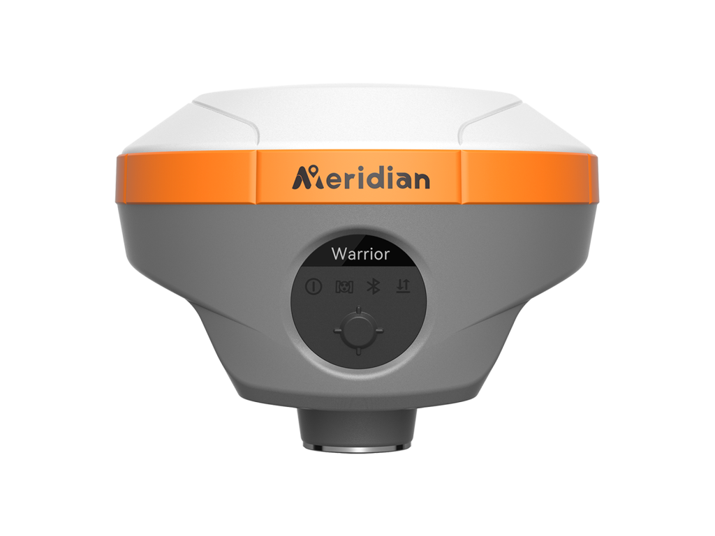
Meridian MBase High Performance Base Receiver

Authorized Seller · Bangladesh
● Genuine Warranty · Dhaka Stock

Meridian MBase High Performance Base Receiver

Price on Request

Contact our sales team for the latest BDT price, base/rover package options, and delivery timeline.

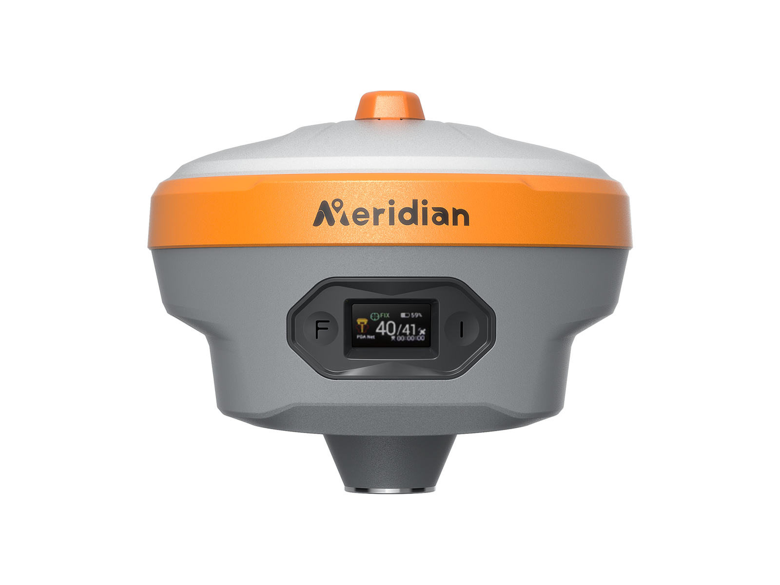
The MBase GNSS receiver is a fully integrated, professional-grade GNSS base station tailored to address 95% of surveyors' requirements for UHF GNSS base and rover operations. It also has built-in 4G connectivity, Bluetooth, Wi-Fi, and a 5W data transmission radio, enabling high-speed data transfer and user-friendly WebUI, which improves efficiency and convenience.
The MBase has a rugged design, making it suitable for outdoor and harsh environments. Equipped with a 5-watt radio module, it ensures reliable GNSS RTK coverage extending up to 35 kilometers under ideal conditions, makes MBase the perfect base station receiver.

Key Features

Longer Working Distance

Equipped the MeridianLink protocol internal radio and upper radio antenna port, Mbase offers up to 35km working range and increases flexibility. By eliminating the need for an external radio, the MBase becomes more lightweight, less complex, and more portable, which can lead to increased efficiency and convenience in the field.

Highly Integrated Four-in-one Antenna

The highly integrated four-in-one antenna on the MBase provides several advantages, including saving space, improving performance and reliability, and reducing the failure rate during use, making Mbase more portable and easier to handle, increasing the efficiency and accuracy of measurements.

Lightweight, Compact & Rugged Design

MBase is an ideal solution for surveyors who require portability and durability in demanding field conditions and eliminates the need for heavy external radio and accessories, ensuring easy transport and quick setup. This combination of lightweight portability, compact form factor, and rugged durability makes it a versatile tool for professionals on the go.

Enhanced Tilt IMU

Equipped with calibration-free IMU, support up to 60° tilt angle within 2cm accuracy, and no limitation tilt angle, allows for quick and accurate measurements without leveling the pole. Concentrate on where the pole tip needs to go, which is especially useful during a stakeout.

GNSS Signal
Channel1408
BDSB1I,B2I,B3I,B1C,B2a,B2b*
GPSL1 C/A,L1C,L2P(Y),L2C,L5
GLONASSL1,L2,L3*
GALILEOE1,E5a,E5b,E6*
QZSSL1C/A, L1C, L2C, L5, L6*
SBASL1, L5*
NavIC(IRNSS)*L5
L-bandB2b PPP (Only for the Asian-Pacific Region) & HAS*
Data FormatCMR, CMR+, RTCM2.X, RTCM3.X
Data OutputNMEA-0183, RINEX, TXT
Data Updating RateUp to 20Hz
Time to Recapture<1s
Cold Start<40s
Positioning Performance
Single Point Positioning (RMS)Horizontal: 1.5m | Vertical: 3.0m
DGPS (RMS)Horizontal: 0.4m | Vertical: 0.8m
Real-Time Kinematic (RMS)Horizontal: ±(8mm+1ppm)
Vertical: ±(15mm+1ppm)
Speed Accuracy (RMS)0.03m/s
Static Accuracy (RMS)Horizontal: ± (2.5mm+0.5ppm)
Vertical: ± (5mm+0.5ppm)
Time Accuracy (RMS)20ns
Speed Accuracy≥0.03m/s
Tilt Compensation Accuracy≤2cm(Tilt Angle≤60°), no tilt angle limitation
IMU Update Frequency200Hz
Communication
BluetoothV5.2 Dual Mode.2.4GHz@+5dBm
WiFiIEEE 802.11 b/g/n
CellularLTE FDD:B1/3/5/7/8/20
LTE TDD:B38/40/41
UMTS/HSPA+:B1/8
GSM/GPRS/EDGE: 900/1800 MHz
Storage32GB, Up to 64GB
Internal RadioTransmitting power:5W, 2W,1W
Frequency: 410~470MHz
Protocol: SOUTH, TRIMTALK 450S, TRIMMK Ⅲ, TRANSEOT.SATEL, MERIDIANLINK
Air Baud Rate: 9600, 19200, 11000
Battery
Specifications7.2V,6600mAh lithium-ion Rechargeable Battery
Operating TimesRTK Rover: Up to 20 hours (Typical Power Consumption)
Static: Up to 35 hours (Typical Power Consumption)
ChargingSupport USB PD 15V/2A (Supports Quick Charging Adapter)
Environment
Operating Temperature-40°C~+85°C
Storage Temperature-55°C~+85°C
Anti-seismic2m Pole Drop Onto Concrete
Dust & waterproofIP68
Control Panel
Display0.96'' OLED Display
LED LampSignal, Power
Physical button2
Physical
I/O Interface1× USB type-C port; 1 × TNC antenna port; 1× SIM card slot; 1 × 5 pin LEMO port
Dimensions133mm×133mm×84.5mm
Weight900g
*All specifications are subject to change without notice.(1) Compliant, GLONASS L3, Galileo E6, Galileo E6 High Accuracy Service (HAS), BDS B2b and SBAS L5 will be provided through future firmware upgrade.(2) Accuracy and reliability are determined under open sky, free of multipaths, optimal GNSS geometry and atmospheric condition. PPP accuracy is subject to the region, environment, and convergence time. High-precision static requires a minimum of 24 hours of long-term observation and precise ephemeris.

* Specifications may vary by configuration. Please confirm with our team before ordering.

Need a Custom Quote or On-Site Demo?

Contact our technical survey engineers in Dhaka. We provide full warranty, local spare parts, and training for all equipment.

Related Equipment